RP Fault Zone one of world’s longest at 1,200 km
By Alcuin Papa
Philippine Daily Inquirer
APART from the profusion of spectacular landscapes and seascapes that has made it the favorite of many travelers, it would seem that the paradise island of Palawan also offers the safest haven for those fearful of a Haiti-like tremor occurring in the country.
Compared to other parts of the Philippines, Palawan is “relatively stable” geologically, according to Mahar Lagmay, a professor of the University of the Philippines National Institute of Geological Sciences (UP-NIGS).
“There are hardly any earthquakes in Palawan and certainly none strong enough to cause major damage. The whole island is probably the most stable area of land in the country,” Lagmay said.
An expert on earthquake faults, Lagmay has constructed a map of earthquake epicenters which he plotted using information from the United States Geological Survey (USGS) from 1929 to 2009.
Lagmay said there were hardly any active faults under the island compared to the rest of the country. (A fault or fault line is a fracture in the rock within the earth’s crust that is the causal location of most earthquakes.)
Continental, not oceanic, rock
While Palawan does have fault lines, these are “old” and experts are still debating whether these fault lines are active or not, Lagmay said.
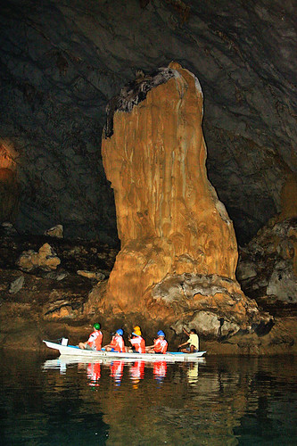
For instance, there is an ongoing and heated debate on whether the Ulugan Bay fault near the famed Palawan Underground River is active, Lagmay said.
Lagmay believes Palawan is stable largely because the island was once part of continental Asia which separated around 100 million years ago and drifted toward the Philippines.
“The rock of the island is continental and different from other parts of the country, which is made of oceanic rock,” he said.
Hence, the crust of the island is thicker at 30 kilometers, compared to the oceanic rock’s 12 km, having derived from the Pacific seabed.
“The crust of the island is thicker and older and, therefore, not as prone to earthquakes,” said Lagmay.
No major faults
The island is also not bordered by any major trench or fault line, he said.
“The South China Sea area is more stable tectonically. Combined with the continental material, there is little chance for the development of active faults in Palawan,” he said.
Also, the movement of the ground in the South China Sea is not as fast as the eastern side of Luzon, which is moving toward the Asian mainland at the rate of 7 centimeters a year, and the eastern side of Mindanao, which is moving toward the Asian mainland at 10 cm a year.
“Because of the slow movement, there is no compression of forces in the island,” Lagmay said.
On the other hand, large parts of the Philippine archipelago are sandwiched between two trenches, the Manila Trench in the west and the Philippine Trench in the east.
“Movements in these trenches generate stress in the faults. That is why there are so many earthquakes in the mainland [Philippines],” he said.
“If you ask me where I would build a house in the country, I’d say Palawan,” he said.
Longest fault system
According to Lagmay, the Philippines is encased in an intricate network of trenches and faults that is one of the most, if not the most complex in the world in terms of tectonics and geology.
The centerpiece of the country’s fault system is the Philippine Fault Zone (PFZ) which is one of the longest in the world at around 1,200 km.
The PFZ starts in Aparri and snakes past the Cordilleras, passing through Nueva Ecija, down to Quezon and the Bondoc Peninsula into Leyte, and from there skipping into northern Mindanao to the southern end of the island into Davao.
The PFZ, Lagmay explained, is a left-lateral strike slip fault. This means that if you were to put one foot on one side of the fault and the other foot on the other side of the fault, the left side of the fault would be moving toward you while the right side would be moving away from you. Also, the right side, or block, would be more advanced than the left block.
A strike-slip fault means the two blocks are moving against each other horizontally.
Lagmay explained that the length of the fault is related to its capacity to generate a large- magnitude earthquake.
“The larger the fault, the greater its potential to produce a strong earthquake,” he said.
In 1990, the PFZ generated a 7.9-magnitude quake that shook Metro Manila and Luzon.
Underwater trenches
Other earthquake fault lines are the trenches running underwater on the western and eastern sides of the country.
There is the Manila Trench on the west of the country which runs from the Batanes islands, curving through the waters off the Ilocos region, Pangasinan, Zambales and into Mindoro island.
According to the Philippine Institute of Volcanology and Seismology (Phivolcs), movement in the Manila Trench caused the Jan. 12 magnitude 5.2 earthquake near Olongapo City that was felt in Metro Manila.
There is also the longer Philippine Trench located underwater east of the country. It runs roughly from waters off Aurora down to Samar, and past Mindanao.
Other underwater trenches in the country include the East Luzon Trough, the Negros Trench that is connected to the Sulu Trench, and the Cotabato Trench.
Smaller faults
In addition, there are also the smaller faults. Notable of the smaller fault lines is the Valley Fault System, also known as the Western Marikina Valley Fault System, which is nearest to Metro Manila.
According to Lagmay, Metro Manila was damaged heavily six times in the last 400 years by earthquakes. But the source of these earthquakes is uncertain.
A study by the USGS and the Phivolcs in 2000 showed that the Valley Fault experienced four large surface rupture events since 600 AD, occurring over a period separated by between 200 and 400 years. The study also said the last fault event in the Valley Fault occurred in the past 200 years.
Lagmay said the Valley Fault is capable of generating an earthquake with a magnitude of between 6 and 7.
Luzon, Mindanao faults
Besides the Valley Fault system, other faults in Luzon include the West Ilocos Fault System, the Dummon River Fault System in Cagayan, the East Zambales Fault, the Iba Fault and the Lubang Fault.
Fault systems in the Visayas include the West Panay Fault, the Southern Samar Lineament, the Central Negros Fault, the Cebu Lineament and the East Bohol Fault.
In Mindanao, there is the Mindanao Fault, the Lanao Fault System, the Davao River Fault, the Central Mindanao Fault and the Tangbulan Fault.
The result of all these faults is that between 5,000 and 7,000 earthquakes occur in the country each year, or an average of between 200 and 250 quakes a day, according to Phivolcs. But most of these earthquakes are not felt. Last year, Phivolcs tallied around 210 earthquakes in the country.
“As we are talking right now, there is a small earthquake occurring somewhere in the country,” Lagmay said.
Read more


The Way They Think